The Rokujurigoe Kaido Pilgrimage Route

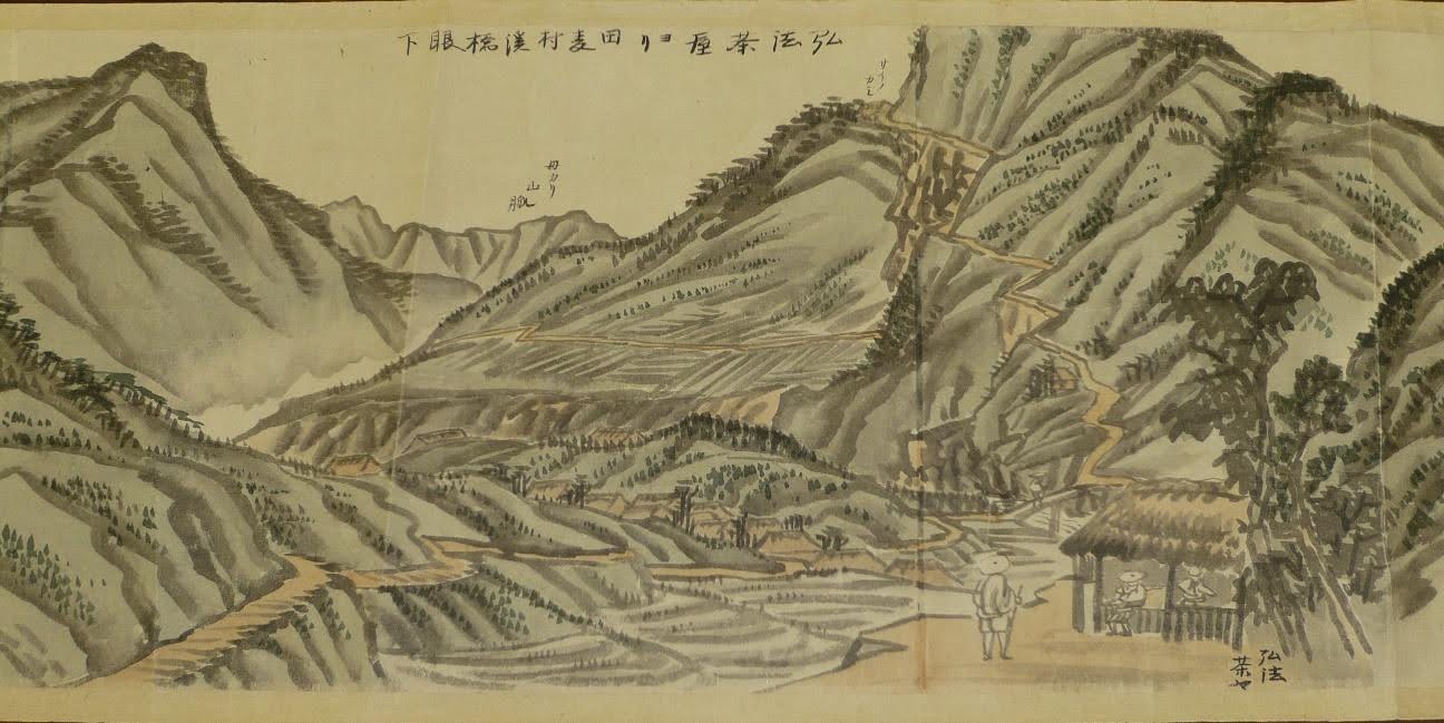
The Rokujurigoe Kaido is a 1,200-year-old route that is believed to have existed since the construction of Churenji (833) and Dainichibo (852), the two main temples of Mt. Yudono located in Oami village.
According to the Dewa Fudoki (出羽風土記), written in 1792, pilgrims had walked the paths of the Rokujurigoe Kaido since the Nara Period (8th century). As it had served as one of the only ways to traverse from the inner lands of Yamagata Prefecture (nairiku 内陸) to the coastal area (Shonai 庄内), it was also used for many purposes beyond faith.
In fact, it was a convenient road even for the military, allowing soldiers from the Shonai region to reach the inner lands when they needed to travel. During the Emishi (native tribes of Northern Japan) revolts in the late 8th and early 9th centuries, the Rokujurigoe Kaido was also used by soldiers to fight the rebels in the North. In 792, General Sakanoue Tamamuro was sent to the lands of Dewa to defeat the Emishi rebels and is said to have followed the Rokujurigoe Kaido trail to travel to the Emishi villages.
In the Edo Period (1604-1868), the route was also taken by the Shonai lords and their army to travel back to the capital (Edo, now Tokyo) every two years. Merchants and farmers also used the Rokujurigoe Kaido to sell their goods in the cities of the nairiku region.
Why has the popularity of the Rokujurigoe Kaido declined over time?

Since the early ages of Mt. Yudono, Shingon Esoteric Buddhism has been highly influential in the area. Legends even say that the founder of Shingon Buddhism himself, Kukai (or Kobo Daishi), made the mountain a sacred place of esoteric Buddhism in the 9th century. Pilgrims from all over Northern Japan flocked to visit this holy place, recognizing its importance in the history of the Shingon sect. In 1733, 157,000 pilgrims visited the mountain.
In the late 16th century (between 1570 and 1592), Mt. Yudono was forcibly made a part of the Dewa Sanzan’s triad of sacred mountains. It was chosen because it was a suitable candidate to replace Mt. Chokai, the former third mountain of the Dewa Sanzan, making the pilgrimage of the Three Sacred Mountains easier for practitioners for geographical reasons. Mt. Chokai was too far from the other two mountains, while Mt. Yudono was in the same mountain range. Though Mt. Yudono did not share much in common with the two other Dewa mountains (Mt. Haguro and Mt. Gassan), Mt. Yudono’s temples agreed to be designated as part of the Dewa Sanzan as they believed it would not be detrimental to them.
In 1868, the new Meiji Goverment, which replaced the former Shogunate system, sought to create a unified Japanese identity and place Shinto at the center of the country’s religious practices. This was called shinbutsubunri (神仏分離), the separation of Shinto and Buddhism. At the same time, religions considered “primitive” or “barbaric” were banned, and Shugendo (Japanese asceticism) was prohibited. In 1869, the government ordered the conversion of the Dewa Sanzan sites to the Shinto religion.
In 1873, five years after the new government’s proclamation of religious separation between Shinto and Buddhism, Mt. Yudono was forcefully converted to Shinto, despite the fierce opposition from the mountain’s main temples: Churenji and Dainichibo. Buddhist statues and icons were removed from Mt. Yudono’s territory (some were kept in Dainichibo and Churenji Temples) or destroyed. Many steles dedicated to the Buddhas of Mt. Yudono along the Rokujurigoe Kaido were damaged, and Buddhist statues were beheaded or destroyed. Mt. Yudono was then officially made a Shinto shrine.
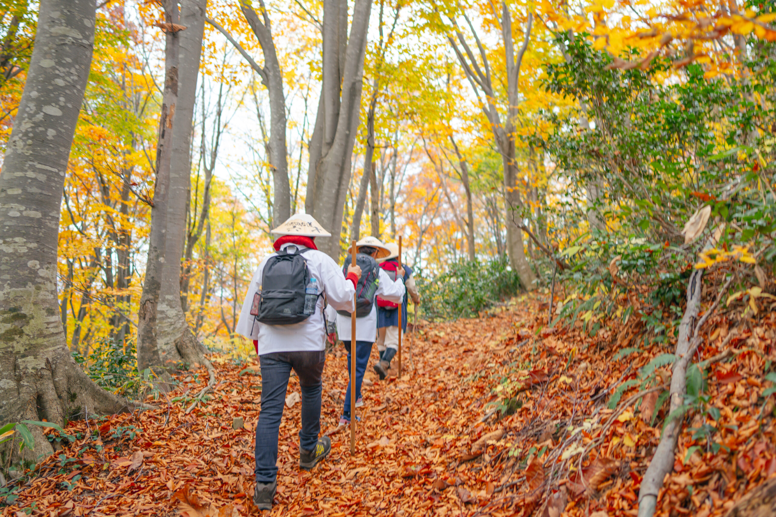
As a result of the forcible conversion of Mt. Yudono, Mt. Yudono and its pilgrimage route were robbed of their true identity and meaning in the eyes of pilgrims. When Mt. Yudono was stripped of its Buddhist identity, the pilgrims stopped walking the tracks of the Rokujurigoe Kaido, which is now trekked mainly by history and nature lovers.
The Bandai-Asahi National Park

Mt. Yudono and part of the Rokujurigoe-kaido pilgrimage trail are included in the Bandai-Asahi National Park. The Bandai-Asahi National Park is the second-largest national park in Japan. It spans an area of 1,863 km² (719 mi²) and encompasses mountains in Yamagata Prefecture, such as the Dewa Sanzan sacred mountains and the Asahi mountain range, as well as areas in Fukushima Prefecture, including the Azuma mountain range, Mt. Bandai, and Lake Inawashiro. The park also extends into Niigata Prefecture, where Mt. Iide is located.
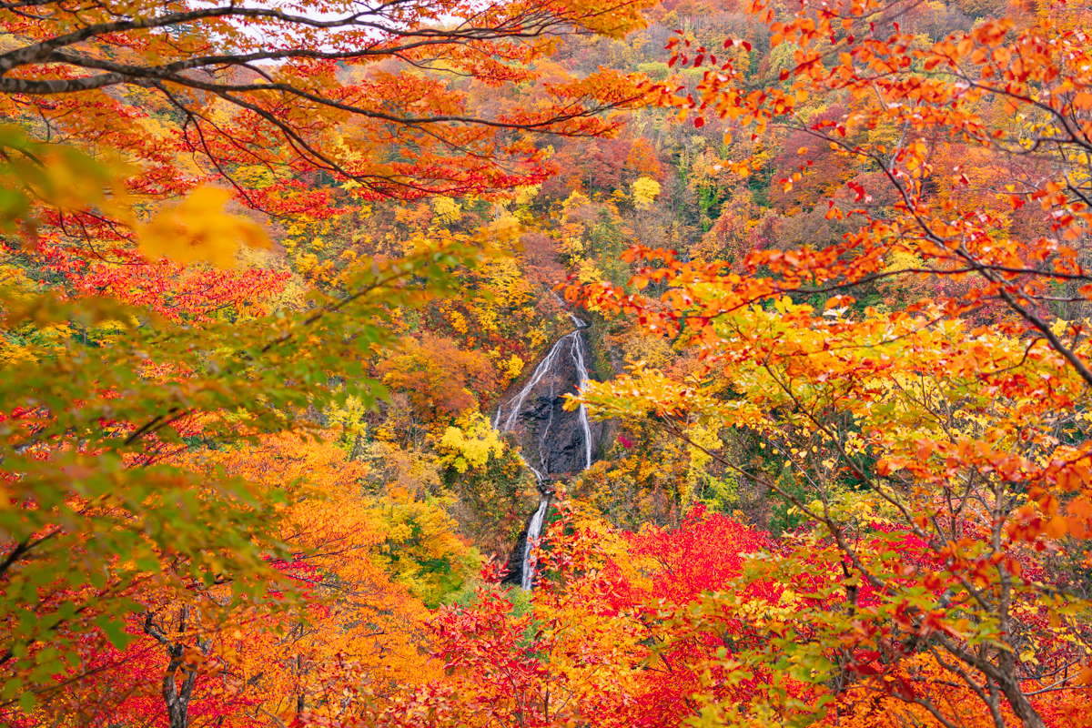
The park is protected for its spiritual history, its wide variety of endemic plants and animal species, and its ancient beech tree forests.
We ask our visitors to be mindful of the environment when hiking within the Bandai-Asahi area: please carry out all trash, avoid picking wild plants, and refrain from disturbing the local fauna.
Practical Tips for Hiking the Rokujurigoe Kaido
The elevation gain on the trail reaches 1,200 meters (3,937 feet). The first part of the course begins at Honmyoji Temple in Tsuruoka City and ends at Shizu Onsen in Nishikawa Town. The temperature at the highest point of the trail (Mt. Yudono’s Yudonosan Shrine) is, on average, 7°C lower than the temperature in the plains, so be sure to pack warmer clothing when hiking the trail.
The area has a continental climate, with snowy winters and warm summers. The seasons are as follows:
- Winter: December to mid-April
- Early Summer: Starts in May
- Summer: Mid-June to late August
- Fall: Early to mid-November
About the Japanese Black Bear
If you decide to hike the Rokujurigoe Kaido alone or in a small group (fewer than 3 people), you should be extra cautious of the Japanese black bear.
Japanese black bears are typically shy and easily scared, so traveling in larger groups can help prevent encounters, as bears can hear the presence of humans and avoid them. However, when traveling alone or quietly, your presence might go unnoticed by the bear, leading to potential surprises. Most bear attacks happen when the bear is startled or feels threatened.
To help avoid bear encounters:
- Always make noise while hiking. Many Japanese stores sell “bear bells”, which can be attached to your hiking gear (e.g., bag or trousers) to alert bears to your presence.
- Do not leave food along the trail.
- NEVER approach baby bears, even if they appear to be alone.
Japanese home centers also sell “bear spray”, which are highly concentrated pepper sprays. Using this can temporarily blind the bear, allowing you to escape.
However, you must do your own research and follow local laws on carrying these self defense sprays while in Japan.
If you do encounter a bear:
- Do not scream, run, or make sudden movements.
- Slowly back away without turning your back, trying to remain as quiet as possible.
If you’re concerned about encountering a bear, don’t hesitate to ask one of our expert guides to accompany you. You may request one in our contact form.
Other Dangers
- Japanese monkeys: Feral monkeys can be aggressive if they feel threatened. Do not attempt to pet or approach them. Avoid eye contact, do not throw food at them, and do not make sudden movements. Take off any shiny jewelry or accessories to prevent injuries caused by the monkeys trying to steal them. Simply walk away calmly.
- Insects: In the summer, there are many mosquitoes and horseflies in Japan. While walking in the forest, the temperature is usually cool enough for you to wear long sleeves and long trousers to protect yourself from insect bites. We recommend regularly applying insect repellent and, if possible, attaching an insect-repelling smoke diffuser to your bag.
Hiking Courses
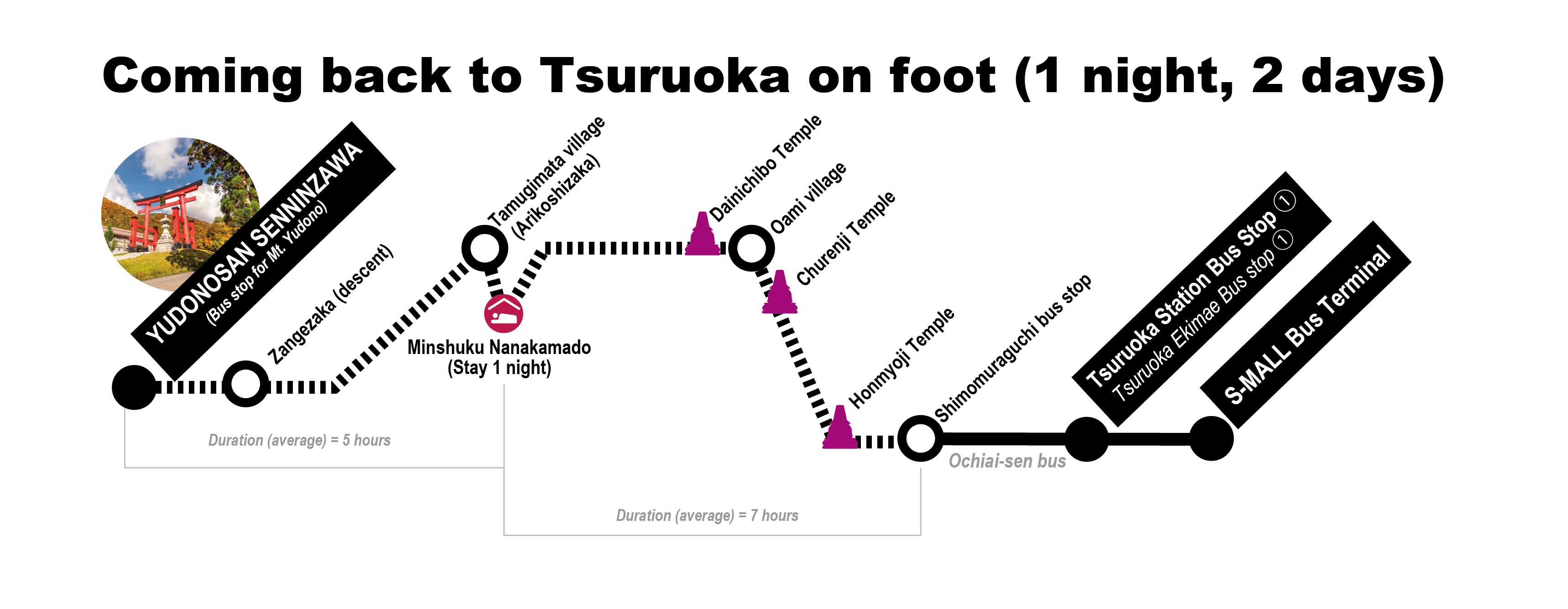
- Stage 1: Honmyoji Temple to Churenji Temple, 4.83 km, 2 hours
Route Link - Stage 2: Churenji Temple to Dainichibo Temple, 2.76 km, 45 minutes
Route Link - Stage 3: Dainichibo Temple to Tamugimata Village and Arikoshizaka Ascent, 5.2 km, 2 hours
Route Link - Stage 4: Arikoshizaka Ascent to Mt. Yudono, 8.5 km, 4-5 hours
Route Link
Access

Bus timetable for the Ochiaisen bus (in Japanese) : https://www.shonaikotsu.jp/local_bus/t13_ochiai.html

